Alteryx Designer Desktop Discussions
Find answers, ask questions, and share expertise about Alteryx Designer Desktop and Intelligence Suite.- Community
- :
- Community
- :
- Participate
- :
- Discussions
- :
- Designer Desktop
- :
- Spatial Tools and Truck Routes
Spatial Tools and Truck Routes
- Subscribe to RSS Feed
- Mark Topic as New
- Mark Topic as Read
- Float this Topic for Current User
- Bookmark
- Subscribe
- Mute
- Printer Friendly Page
- Mark as New
- Bookmark
- Subscribe
- Mute
- Subscribe to RSS Feed
- Permalink
- Notify Moderator
What's up everybody!
I am trying to calculate distance between two points for truck routing, but I find that the distance tool is getting crushed because we have some 1000+ mile distances. Are there any best practices for long distance calculations? Does anyone know of a way to limit the travel to routes that are "truck safe"? I am really interested in the possibilities here, so any advice is welcome! (example attached)
Treyson
Managing Partner
DCG Analytics
Solved! Go to Solution.
- Labels:
-
Spatial Analysis
- Mark as New
- Bookmark
- Subscribe
- Mute
- Subscribe to RSS Feed
- Permalink
- Notify Moderator
For something like this I would look into using the Google Directions API and DistanceMatrix API. It's easy to build the URL in Alteryx and parse out the response (XML or JSON). With Google, you'd get the flexibility to add waypoints to the route (ex assume your truck as to visit different distribution centers, etc.) as well as specific preferences to do things like avoid toll roads. The documentation is here:
https://developers.google.com/maps/documentation/directions/
- Mark as New
- Bookmark
- Subscribe
- Mute
- Subscribe to RSS Feed
- Permalink
- Notify Moderator
Have you done this process before? I am having some issues with the URL here and I need some help. I have attached a new copy of the YXDB. I removed my key from this, but I know the key is fine becasue it was working with the examples provided.
I am glad that you showed me this because I wanted to learn the download tool anyay.
Managing Partner
DCG Analytics
- Mark as New
- Bookmark
- Subscribe
- Mute
- Subscribe to RSS Feed
- Permalink
- Notify Moderator
Hi @Treyson,
Attached are 2 workflows that should help you get started. The first connects to the Google DistanceMatrix API (as mentioned by @dataMack) and does a simple distance calculation. The second uses the Google Maps Directions API (thanks again Jason!) to avoid tolls and ferries and outputs directions as well as an overall distance. Definitely a good place to get started when learning the download tool - this one even lets you explore Blob type fields a bit!
*For both workflows, be sure to enter your API key (each will have a separate API key as they reference different APIs) in the Formula tool after the Join.
Cheers,
Senior Solutions Architect
Alteryx, Inc.

- Mark as New
- Bookmark
- Subscribe
- Mute
- Subscribe to RSS Feed
- Permalink
- Notify Moderator
This is the coolest thing I have seen all day! Thank you so much!
Managing Partner
DCG Analytics
- Mark as New
- Bookmark
- Subscribe
- Mute
- Subscribe to RSS Feed
- Permalink
- Notify Moderator
Happy to help!
Senior Solutions Architect
Alteryx, Inc.

- Mark as New
- Bookmark
- Subscribe
- Mute
- Subscribe to RSS Feed
- Permalink
- Notify Moderator
Hi All,
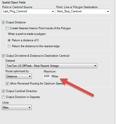
I have Lat/ long points and i need to calculate the total length of the trip in miles? How should i go about it? i have used the poly-build and used the options length(miles). is that correct? thanks
-
Academy
6 -
ADAPT
2 -
Adobe
203 -
Advent of Code
3 -
Alias Manager
77 -
Alteryx Copilot
24 -
Alteryx Designer
7 -
Alteryx Editions
91 -
Alteryx Practice
20 -
Amazon S3
149 -
AMP Engine
250 -
Announcement
1 -
API
1,206 -
App Builder
116 -
Apps
1,359 -
Assets | Wealth Management
1 -
Basic Creator
14 -
Batch Macro
1,554 -
Behavior Analysis
245 -
Best Practices
2,690 -
Bug
719 -
Bugs & Issues
1 -
Calgary
67 -
CASS
53 -
Chained App
267 -
Common Use Cases
3,820 -
Community
26 -
Computer Vision
85 -
Connectors
1,424 -
Conversation Starter
3 -
COVID-19
1 -
Custom Formula Function
1 -
Custom Tools
1,935 -
Data
1 -
Data Challenge
10 -
Data Investigation
3,485 -
Data Science
3 -
Database Connection
2,216 -
Datasets
5,216 -
Date Time
3,226 -
Demographic Analysis
186 -
Designer Cloud
738 -
Developer
4,364 -
Developer Tools
3,525 -
Documentation
526 -
Download
1,036 -
Dynamic Processing
2,935 -
Email
927 -
Engine
145 -
Enterprise (Edition)
1 -
Error Message
2,253 -
Events
196 -
Expression
1,867 -
Financial Services
1 -
Full Creator
2 -
Fun
2 -
Fuzzy Match
711 -
Gallery
666 -
GenAI Tools
3 -
General
2 -
Google Analytics
155 -
Help
4,704 -
In Database
965 -
Input
4,290 -
Installation
360 -
Interface Tools
1,900 -
Iterative Macro
1,091 -
Join
1,956 -
Licensing
252 -
Location Optimizer
60 -
Machine Learning
259 -
Macros
2,858 -
Marketo
12 -
Marketplace
23 -
MongoDB
82 -
Off-Topic
5 -
Optimization
750 -
Output
5,246 -
Parse
2,325 -
Power BI
227 -
Predictive Analysis
936 -
Preparation
5,161 -
Prescriptive Analytics
205 -
Professional (Edition)
4 -
Publish
257 -
Python
853 -
Qlik
39 -
Question
1 -
Questions
2 -
R Tool
476 -
Regex
2,339 -
Reporting
2,429 -
Resource
1 -
Run Command
573 -
Salesforce
276 -
Scheduler
410 -
Search Feedback
3 -
Server
628 -
Settings
932 -
Setup & Configuration
3 -
Sharepoint
624 -
Spatial Analysis
599 -
Starter (Edition)
1 -
Tableau
512 -
Tax & Audit
1 -
Text Mining
468 -
Thursday Thought
4 -
Time Series
430 -
Tips and Tricks
4,183 -
Topic of Interest
1,126 -
Transformation
3,721 -
Twitter
23 -
Udacity
84 -
Updates
1 -
Viewer
3 -
Workflow
9,965
- « Previous
- Next »


