Weekly Challenges
Solve the challenge, share your solution and summit the ranks of our Community!Also available in | Français | Português | Español | 日本語
IDEAS WANTED
Want to get involved? We're always looking for ideas and content for Weekly Challenges.
SUBMIT YOUR IDEA- Community
- :
- Community
- :
- Learn
- :
- Academy
- :
- Challenges & Quests
- :
- Weekly Challenges
- :
- Re: Challenge #100: Find Ned!
Challenge #100: Find Ned!
- Subscribe to RSS Feed
- Mark Topic as New
- Mark Topic as Read
- Float this Topic for Current User
- Bookmark
- Subscribe
- Mute
- Printer Friendly Page
- Mark as New
- Bookmark
- Subscribe
- Mute
- Subscribe to RSS Feed
- Permalink
- Notify Moderator
Dropbox is blocked at my company as other companies like mine source code should never be stored on external sites. Can you place the data files on https://github.com/alteryx as GitHub is not blocked for me?
- Mark as New
- Bookmark
- Subscribe
- Mute
- Subscribe to RSS Feed
- Permalink
- Notify Moderator
Finally got mine tidied up and working... pleasantly close to Ned (0.4 m) run time 1m 16s

- Mark as New
- Bookmark
- Subscribe
- Mute
- Subscribe to RSS Feed
- Permalink
- Notify Moderator
Got to within 17.1 meters of Ned in 14 seconds
- Mark as New
- Bookmark
- Subscribe
- Mute
- Subscribe to RSS Feed
- Permalink
- Notify Moderator
- Mark as New
- Bookmark
- Subscribe
- Mute
- Subscribe to RSS Feed
- Permalink
- Notify Moderator
@darryl5280, I'll see what we can do! I'll post back when I have an update!
- Mark as New
- Bookmark
- Subscribe
- Mute
- Subscribe to RSS Feed
- Permalink
- Notify Moderator
- Mark as New
- Bookmark
- Subscribe
- Mute
- Subscribe to RSS Feed
- Permalink
- Notify Moderator
Okay, I've never done spatial analysis before so this challenge was quite difficult for me. After hours of hopelessly wondering in the Colorado outback I decided to get some help and was inspired by @LordNeilLord 's solution. Anyways, learned a lot about the spatial tools and think this was a fun excercise!
- Mark as New
- Bookmark
- Subscribe
- Mute
- Subscribe to RSS Feed
- Permalink
- Notify Moderator
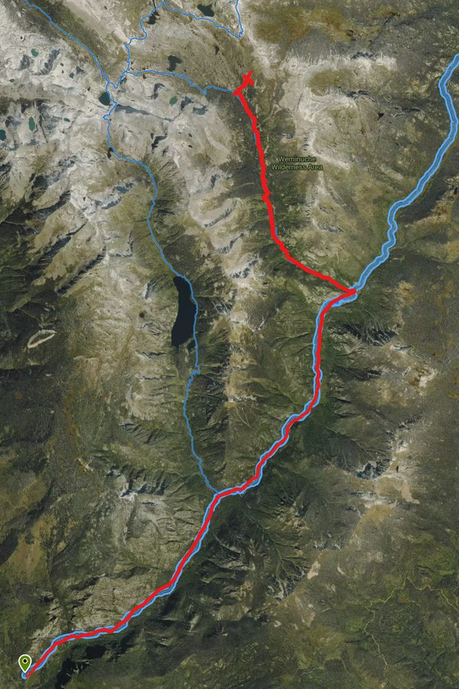
So I think we need to organize an expedition to this spot next summer. It looks like its about 16 miles hiking from the nearest trail head (one way), so its probably at least 2 days round trip. I think I've found the best route:
https://goo.gl/maps/H2VEPtzAUYU2
Who's in?
- Mark as New
- Bookmark
- Subscribe
- Mute
- Subscribe to RSS Feed
- Permalink
- Notify Moderator
Or maybe I found a better route. Hard to measure distance because google doesn't have the trails.
Starting from the south: https://www.hikingproject.com/trail/7032122/pine-river-trail-523
Probably a similar distance, but less vertical.
- Mark as New
- Bookmark
- Subscribe
- Mute
- Subscribe to RSS Feed
- Permalink
- Notify Moderator
This one was a fun exploration of the spatial tools. After many different attempts and approaches, landed on using grids of shrinking sizes. Rinse and repeat the gridding process, finding the one furthest from the roads.
I wanted to embed the "How Close is Ned" app into my workflow, and create an iterative macro that would loop until the workflow gets you to under 1 km away, but couldn't figure out 1) how to call the app, and 2) how to get the results written to a format that can be used for comparison. Would love suggestions & feedback here!
25.1 seconds is very reasonable to get within 3 m.

-
Advanced
273 -
Apps
24 -
Basic
128 -
Calgary
1 -
Core
112 -
Data Analysis
170 -
Data Cleansing
4 -
Data Investigation
7 -
Data Parsing
9 -
Data Preparation
195 -
Developer
35 -
Difficult
69 -
Expert
14 -
Foundation
13 -
Interface
39 -
Intermediate
237 -
Join
206 -
Macros
53 -
Parse
138 -
Predictive
20 -
Predictive Analysis
12 -
Preparation
271 -
Reporting
53 -
Reporting and Visualization
17 -
Spatial
59 -
Spatial Analysis
49 -
Time Series
1 -
Transform
214
- « Previous
- Next »


